 I've been monitoring the NASA Space Shuttle since take off, through the inspections and EVAs, the send-off dinner provided by the Russians with chocolate for dessert, and I hope to continue to watch through to the landing. It is fascinating seeing this all live and acclimating to my interests and curiousities.
You can watch the live feed from here:
http://www.nasa.gov/multimedia/nasatv/live_tv.html
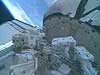
Often, during lulls, NASA show the world map from the "big board." It shows the positions of the ISS station and the Discovery orbiter. I wondered if I could see the same thing. This interest arose particularly when they'd show exterior shots. I would often wonder where they were, or like astronaut Sellers would often ask Fossum during EVA, "What's that?" pointing to the spinning Earth.
I found this link in NASA. It requires Java within your browser:
http://spaceflight.nasa.gov/realdata/tracking/
It is quite good. It shows the daylight pattern like geoclocks. It includes the latitude and longitude of the station, speed, height above the Earth, and so on. Wow! If you zoom in, it goes full colour.
 It was kinda of weird today mid-afternoon thinking, "Hey, they're up there." I turned to the north, looking out my window, wondering about them.
I also found a site (Heavens Above) that shows the space station floating over a globe. It gives a sense of what it looks like from their perspective. Includes other satellite sighting calculators...
I also grew interested in the layout of the space station. I continue to search for something that helps me really get a sense of its current layout... The exploded diagram is interesting. But I think I'd like something a little more interactive.
OK. I need to get back to work!


No comments:
Post a Comment